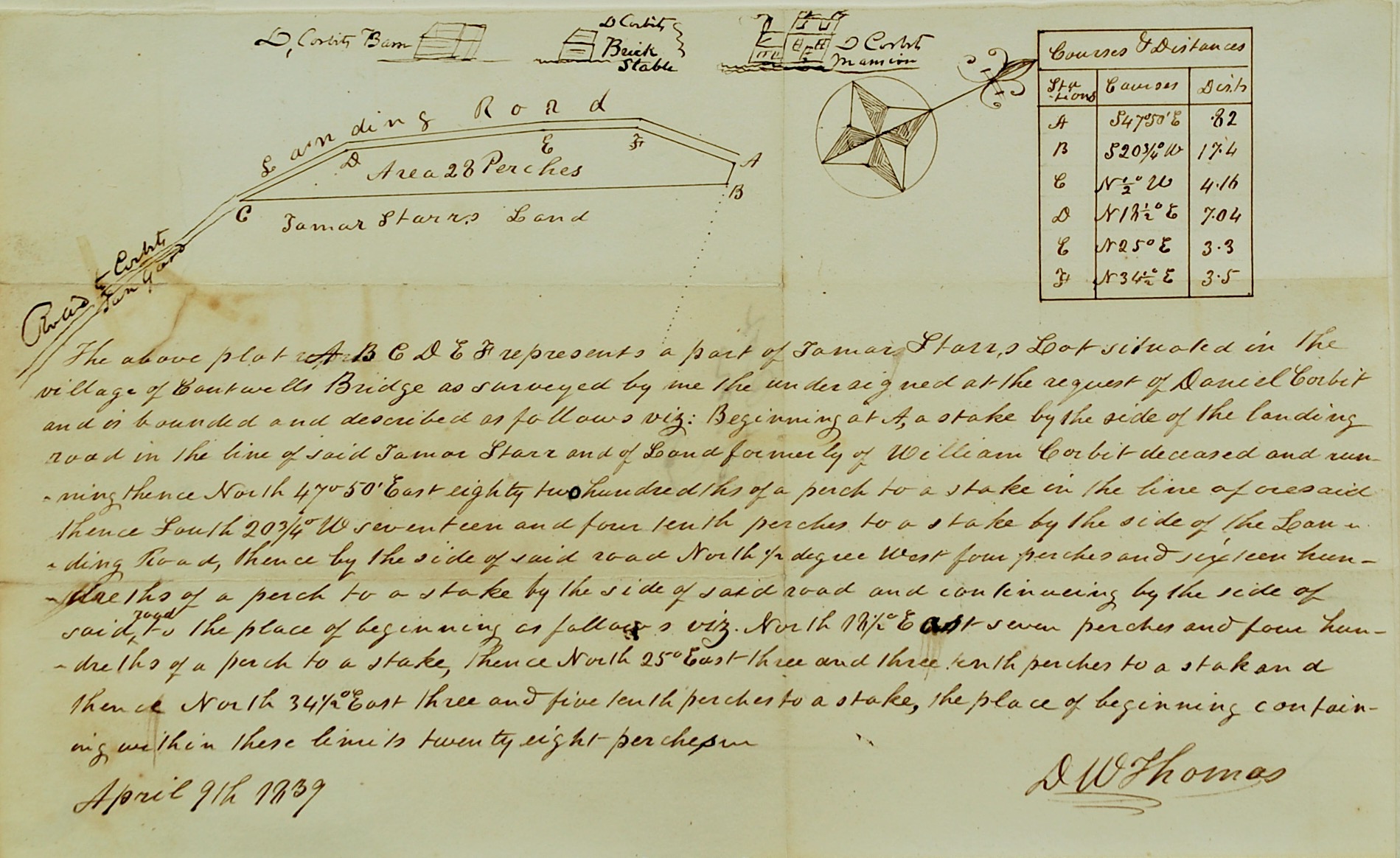
Survey map for Tamar Starr and William Corbit
Odessa, Delaware
1839
April 9, 1839
Maker
D. W. Thomas
Measurements
7-5/8 in x 12-3/8 in
Materials
Ink on paper
Credit Line
Historic Odessa Foundation, gift of Mrs. D. Meredith Reese
Accession Number
1963.163
Inscription
The survey map is dated "April 9th 1839" and signed "D W Thomas" across the bottom.
Provenance
This survey descended through the Corbit family to the donor.
Comments
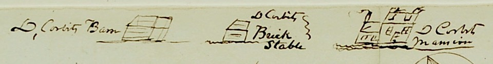
The hand-written survey or plat describes "part of Lamar Starr's Lot situated in the / village of Cantwells Bridge . . . ." Sketches at the top show the "Landing Road," "Road to Corbits / Tan Yard," and Daniel Corbit's barn, brick stable, and mansion house, as well as a table of "Courses & Distances." It has sketches of the Corbit house, brick stable, and barn at the top. For an earlier survey of the Corbit mansion lot, see accession no. 1963.162.