

Survey map of David Wilson lands
Odessa, Delaware
1829
Maker
Stephen Willis
Measurements
8-1/8 in x 7-1/2 in (folded)
Materials
Ink, pencil, and watercolor on paper
Credit Line
Historic Odessa Foundation, gift of the estate of H. Rodney Sharp
Accession Number
2016.13
Inscription
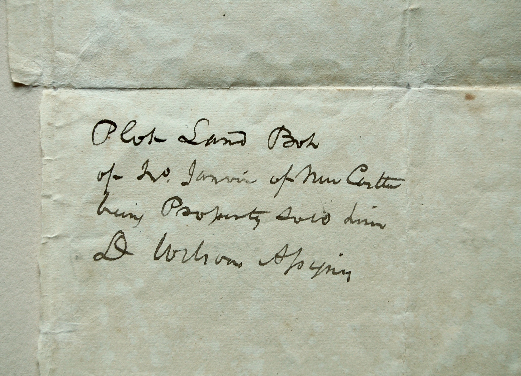
“Representations of part of the Lands belonging to David / Wilson at Cantwell’s Bridge. Made in January 1829 / Steph. Willis” is written in ink across the bottom of the map; “Plot Land Bot / of Jno. Janvier of New Castle / being Property sold him / D Wilson Asignee” is written in ink on the back [see accompanying image], and “Plot of Lot adjoining Tan yard” is in ink across the back of the folded upper half of the paper [see accompanying image].
Condition Notes
The map is shown folded.
Provenance
This survey map was likely acquired by H. Rodney Sharp at the time he bought the Corbit house, but no particulars are known.
Comments
Purchases and sales of land required sufficient description for the buyer and seller. Land deeds incorporated detailed, often tedious, delineation of the plot boundaries, frequently noting landmarks that no longer survive. Survey maps portrayed those features visually. Surveyor Stephen Willis sketched such a plat when landowner David Wilson Jr. faced severe indebtedness requiring sales of his land in January of 1829. An inscription on the back of the map states that it showed land bought by John Janvier of New Castle (a collateral relation of the cabinetmakers). “Appoquinimink Creek” borders much of the property and is identified by widely spaced letters along its southern bank. Willis picked out notable tree landmarks in green. Daniel Corbit’s name appears lightly in pencil in each of three subdivisions, characterized as “Upland,” “Marsh,” and “Marsh & Meadow.” The map also marks the “Road to the Tan Yard” as well as the tan yard itself, noted immediately below the north arrow.
Bibliography
Zimmerman, A Storied Past, 257-258.