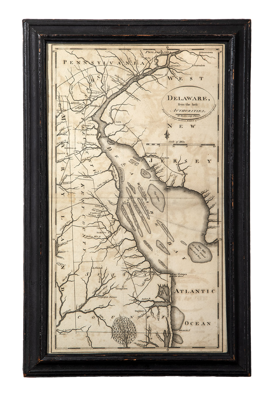
Map, "Delaware, from the best Authorities."
Philadelphia, Pennsylvania
c. 1795
Maker
Engraver, William Barker (1770-1805)
Cartographer, Matthew Carey (1760-1839)
Measurements
18-3/4 in x 12 in (sight, 16-1/2 in x 9-1/2 in)
Materials
Ink on laid paper
Credit Line
Historic Odessa Foundation, gift of H. Rodney Sharp
Accession Number
1959.3670
Inscription
"Delaware, from the best Authorities" is printed within the oval cartouche, along with “W. Barker, sculp. Philada.” in smaller lettering. “Engraved for Carey’s American Edition of Guthrie’s Geography improved.” is printed along the bottom outside of the cartouche.
Condition Notes
The map exhibits minor toning.
Provenance
Ex coll. H. Rodney Sharp
Comments
This map was made for The General Atlas for Carey's Edition of Guthrie's Geography Improved, printed in Philadelphia in 1795. In addition to marking many towns along the Delaware River, it identifies many of the large shoals that impacted shipping. The map showa the “Apoquinimy” and Drawyer’s creeks and notes “Bridge,” presumably Cantwell’s. It also illustrates the short distance separating the Appoquinimink from the Bohemia and Sassafras rivers, which empty into the Chesapeake Bay.