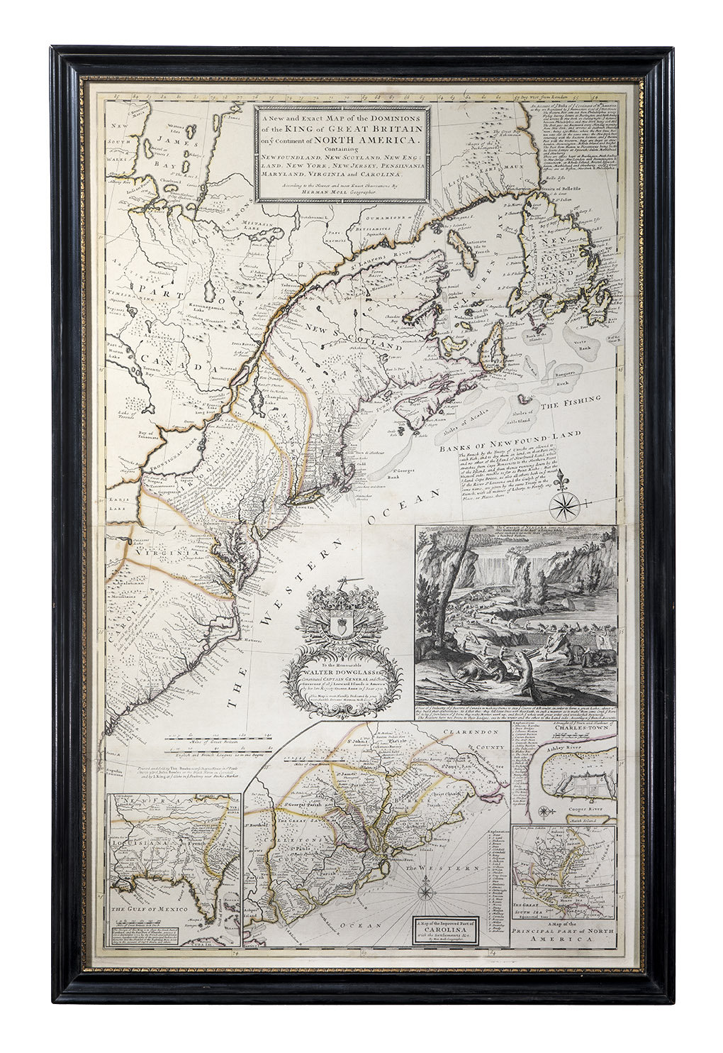
"A New and Exact Map"
London
1715
7th state, c. 1733
Maker
Herman Moll (c. 1654–1732)
Measurements
41-1/2 in x 25-7/8 in
Materials
Ink and colored washed on paper.
Credit Line
Historic Odessa Foundation, gift of H. Rodney Sharp
Accession Number
1958.3528
Inscription
"To the Honour-able / WALTER DOWGLASS Esqr.”; “TheCataract of Niagara.”; “A View of yeIndustry of yeBeavers of Canada.”; “ADraught of yeTown and Harbour of /Charles-town.”; “South Part of Carolinaand the East Part of Florida.”; “A Map ofthe Improved part of / CAROLINA / withthe Settlements &c. / By Her. MollGeographer.”; and “A Map of the /Principal part of North / America.”identify the various insets in the map.
Condition Notes
The map is laid down on cardboard.
Provenance
Ex coll. H. Rodney Sharp
Comments
The full map title is: "A New and Exact Map of the Dominions of The KING of GREAT BRITAIN on ye Continent of NORTH AMERICA, containing Newfoundland, New Scotland, New England, New York, New Jersey, Pensilvania, Maryland, Virginia and Carolina; according to the newest and most exact observations by Herman Moll Geographer."
William Corbit owned two maps, listed in his parlor, at his death in 1818. They were not described but may have been similar in scope and detail as this map. It shows the eastern part of North America and renames some French settlements with English names, thus subtly reinforcing British efforts to control lands west and north of the thirteen original colonies. One of the map insets pictures Niagara Falls, one of the wonders of the continent. The foreground shows a large colony of industrious beavers, signalling both the importance of beaver furs and hard work, and inspiring the popular name "the beaver map."
Bibliography
Zimmerman, A Storied Past, 259-260.